(IN FRENCH w/ Interpretation) Public Presentation: Assessing coastal flood and erosion risks in relation to climate change and future sea-level rise
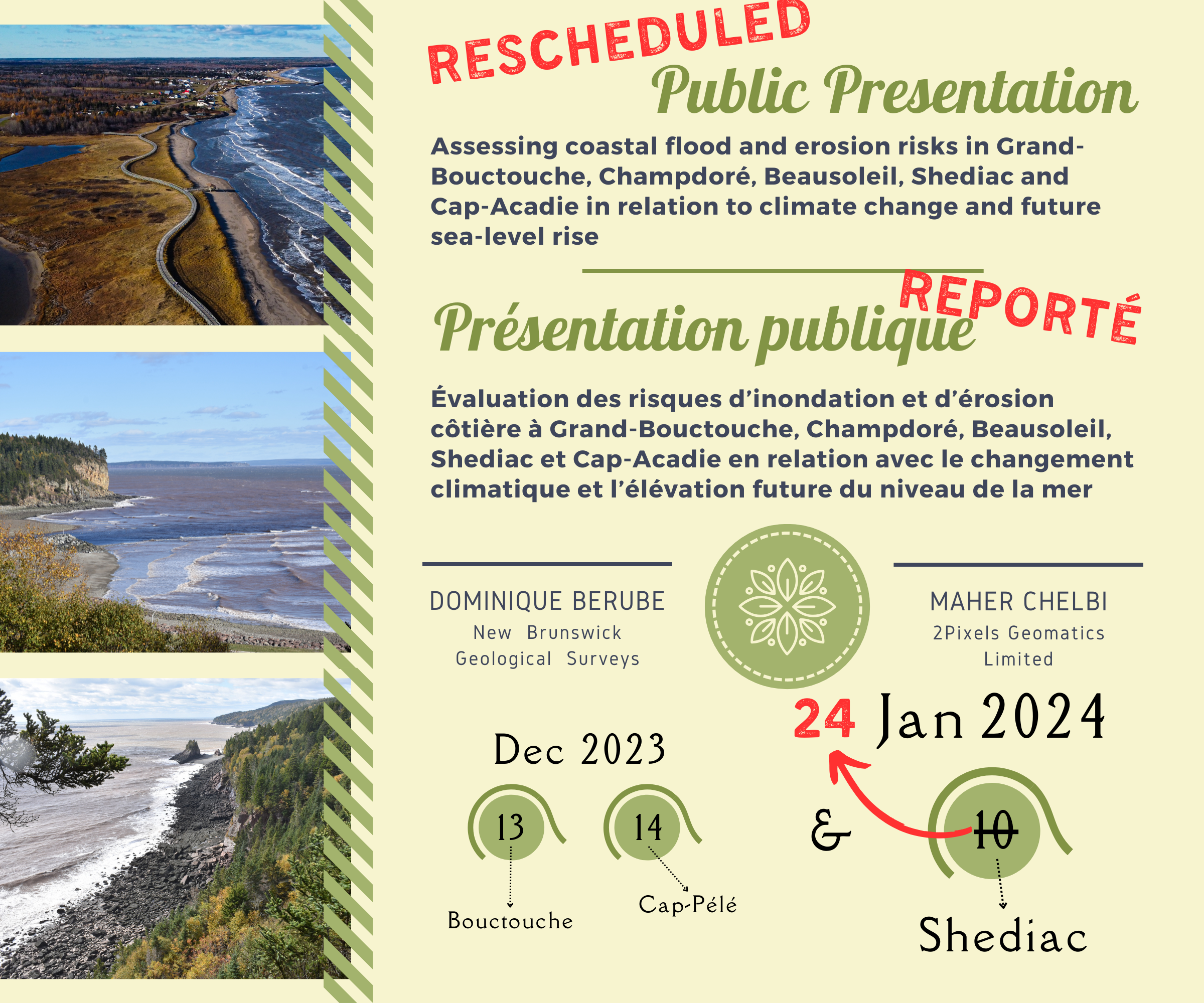
Event Dates and Locations
13th December - Bouctouche, NB @ the JK Irving Centre
14th December - Cap-Pélé, NB @ the Club d'âge d'or
10th January - Shediac, NB @ the Hotel Shediac - postponed due to inclement weather
NEW DATE - 24 January - Shediac, NB @ the Hôtel Shediac
Note - this event will have LIVE INTERPRETATION for anglophone speakers
The New Brunswick Climate Change Action Plan recognizes the importance of natural habitats (ex: sandy beaches and dunes, salt marshes) in buffering the impacts of sea-level rise and storm surges (ex: flood reduction, erosion control), and underlines that all new infrastructures built in the coastal zone should be designed to withstand future climate conditions.
The New Brunswick Geological Surveys (NBGS) participate in the production of the geospatial information needed to better understand the short- and long-term evolution of coastal habitats. Coastal geomorphology studies conducted by the NBGS focus on coastal flooding and erosion processes, as well as on human activities leading to major shoreline or coastline changes, resulting in a degradation of natural environment.
The also helps manage the coastal habitats of the province, by giving priority to their environmental (ex: conservation, sustainability), social (ex: sports, leisure) and economic values (ex: jobs, royalties), in order to support a high quality of life for current and future generations of New Brunswickers. The New Brunswick Climate Change Fund allows a better financing of coastal geomorphology studies and, therefore, to better manage coastal habitats and maintain their ecological services.
The present study aims at producing high resolution geospatial data in Arc GIS format for five local governance entities of New Brunswick located along Northumberland Strait, in order to identify coastal infrastructures that could be damaged or destabilized in the future due to climate change and rapid sea-level rise.
The entities targeted in this study are:
- Grand-Bouctouche
- Champdoré
- Beausoleil
- Shediac
- Cap-Acadie
The main objectives of this study are to:
- calculate and project historic coastal erosion rates based on an analysis of the 1940’s, 1980’s and 2020’s aerial photos
- select and apply coastal flood scenarios presented on GeoNB portal (elevation of water levels based on CGVD2013)
- generate geospatial data showing coastal areas and infrastructures that will be at risk of flooding and erosion in 2030, 2050 and 2100
- produce a final report that focuses on the data collection methodology and provides a detailed inventory of infrastructures at risk
- present the results and conclusions of the study during public meetings organized in collaboration with the New Brunswick Environmental Network
The geospatial data generated in this study highlighted the impact of the last major coastal storms (ex: Dorian, Fiona) and the growing effect of climate change along Northumberland Strait, putting the natural environment and human activities at risk. It is thus crucial to integrate this type of data into the land planning process and also use the information to improve emergency response plans.
There is no doubt that managing coastal erosion and flooding risks in New Brunswick requires a long-term vision, a commitment to environmental sustainability, and a willingness to make hard decisions to protect current and future generations. By acting proactively and collaboratively, local governance entities can hope to forge a resilient future in the face of these complex and ever-evolving challenges.
Event Information
| Event Date | Jan-24-2024 7:00 pm - 9:00 pm |
| Location | Hôtel Shediac |
| Categories | Public Presentation, Climate Change Adaptation Collaborative |
We are no longer accepting registration for this event
